Service · 3D mapping and modeling
3D mapping and modeling from the air.
Point clouds, textured meshes and surface models built from your actual site — something you can rotate, section and measure rather than just look at.
Flight log · Real project
A finished site, rebuilt in 3D.
Two flythroughs of a textured 3D model SkyMap built from overlapping drone photographs of a commercial maintenance facility. Every surface you see, from the roofs and bay doors to the pavement markings and the sign by the road, comes from the photos, not from a drawing.
Flight log · 360° tour
Walk the jobsite in 360°.
An interactive 360° walk-through of the new Academy Sports store under construction in Mount Pleasant, captured by SkyMap. Drag to look around, then click the black arrows to continue the walk-through rather than the photos along the bottom.
What you get
Three different things, often together.
Point cloud
Millions of measured points, each with a position and a color. The raw geometry of the site, and what most engineering software wants to be fed.
Textured mesh
The point cloud turned into a solid surface with the photography wrapped over it. This is the one you show people — it looks like the site because it is the site.
Digital surface model
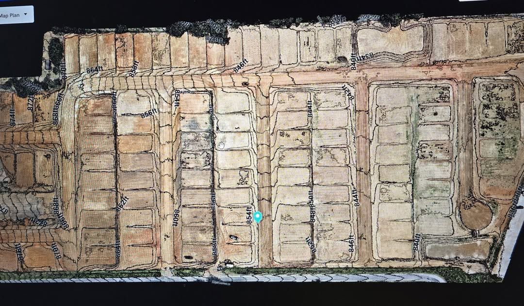
A height value for every cell of the site. The basis for contours, slope analysis, drainage checks and every volume calculation we run.
Why photogrammetry works
Parallax, several hundred times over.
Two eyes give you depth because each sees a slightly different angle. Photogrammetry is that idea taken to an extreme.
The aircraft photographs every point on the site from dozens of positions. Software finds the same physical feature across all those frames, works backwards to where the camera must have been, and solves for where that feature sits in three dimensions. Do it for millions of features and you have a model.
Two things wreck it: motion blur and bad geometry. The mechanical shutter deals with the first. A properly planned grid with real overlap deals with the second. Skip either and you get a model that looks fine and measures wrong.
What it is for
Beyond looking impressive.
- As-built against design. Drop the model over the design surface and see where reality drifted.
- Volumes. Every cut and fill number we produce comes off a surface model. More on that here.
- Sections and profiles. Slice the site anywhere and get a real cross section without sending anyone out with a rod.
- Drainage. Slope and flow direction across the whole pad, before the first rain tells you the hard way.
- Showing people. An owner, a lender or a city council understands a model in about four seconds. Drawings take longer.
Talk it through
Tell us the site and we will tell you the number.
Most jobs get a straight answer the same day. Call (903) 380-2389 or send the details and we will come back with a price and a date.