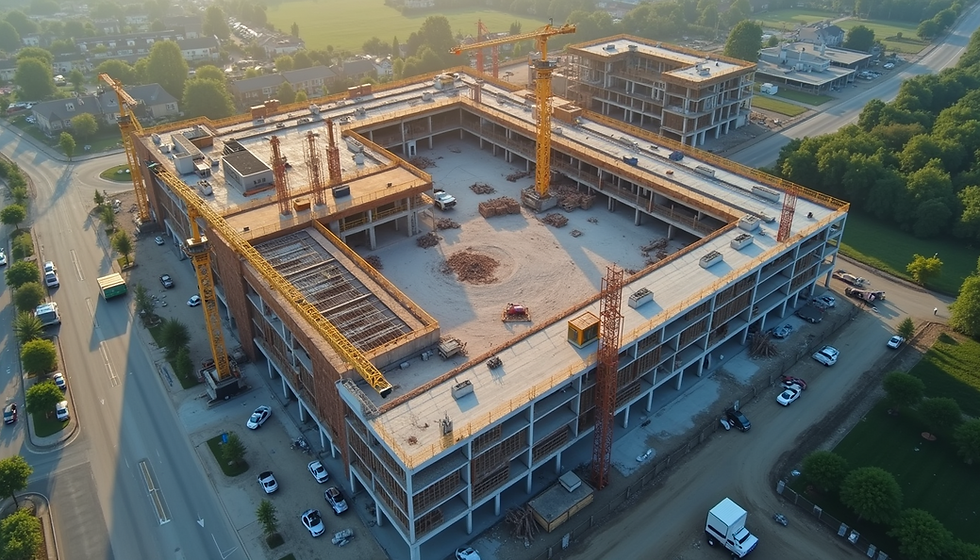
Enhance Your Projects with Drone Mapping
- skymapdrones
- 13 minutes ago
- 4 min read
You want to improve your project outcomes with precise, efficient, and cost-effective methods. Drone-based mapping solutions offer a powerful way to achieve this. These solutions provide detailed aerial data that helps you monitor progress, plan better, and make informed decisions. Using drones for mapping is no longer a luxury but a necessity for modern construction and development projects.
Understanding Drone-Based Mapping Solutions
Drone-based mapping solutions use unmanned aerial vehicles equipped with cameras and sensors to capture high-resolution images and data from above. These images are processed to create accurate maps, 3D models, and progress reports. The technology allows you to cover large areas quickly and safely, reducing the need for manual surveys.
You can use these solutions for various purposes:
Site surveys and topographic mapping
Progress monitoring and reporting
Volume calculations for stockpiles
Inspection of hard-to-reach areas
Environmental and land use analysis
The data collected is precise and up-to-date, enabling you to track changes and identify issues early. This reduces risks and helps you stay on schedule and budget.

Benefits of Drone-Based Mapping Solutions for Your Projects
Implementing drone-based mapping solutions brings several advantages that directly impact your project’s success:
Speed and Efficiency
Drones cover large areas in a fraction of the time it takes for traditional ground surveys. This means you get faster results and can make quicker decisions.
Cost Savings
Reducing the need for manual labor and expensive equipment lowers your overall project costs. Drones also minimize the risk of accidents during site inspections.
Accuracy and Detail
High-resolution images and precise GPS data ensure your maps and models are reliable. This accuracy supports better planning and reduces errors.
Safety
Drones can access dangerous or difficult locations without putting personnel at risk. This is especially important for inspecting tall structures or unstable terrain.
Improved Communication
Visual data from drones helps you communicate progress and issues clearly with stakeholders, clients, and team members.
Using drone mapping services ensures you receive professional support and high-quality data tailored to your project needs.
How to Integrate Drone-Based Mapping Solutions into Your Workflow
To maximize the benefits of drone-based mapping solutions, follow these practical steps:
Define Your Objectives
Identify what you want to achieve with drone mapping. Are you tracking progress, conducting inspections, or creating topographic maps? Clear goals help you choose the right equipment and services.
Select a Reliable Service Provider
Partner with a company that offers professional drone mapping services. Look for experience, certifications, and a proven track record in your industry.
Plan Your Flights
Work with your provider to schedule drone flights at key project stages. Consider weather conditions, site access, and safety regulations.
Review and Analyze Data
After each flight, review the maps, models, and reports. Use this data to identify issues, verify measurements, and update project plans.
Incorporate Data into Project Management
Integrate drone data with your existing project management tools. This ensures all team members have access to the latest information.
Train Your Team
Educate your staff on how to interpret drone data and use it effectively. This increases the value of the information collected.
By following these steps, you ensure drone-based mapping solutions become a seamless part of your project workflow.

Practical Applications of Drone-Based Mapping Solutions
Drone-based mapping solutions serve many practical purposes in construction and development projects. Here are some specific examples:
Site Planning and Design
Use detailed topographic maps to design layouts that fit the terrain. This reduces costly changes during construction.
Progress Monitoring
Regular drone flights provide visual updates on construction progress. Compare images over time to track milestones and identify delays.
Volume Measurement
Calculate stockpile volumes accurately without manual measurements. This helps with inventory management and billing.
Inspection and Maintenance
Inspect roofs, bridges, and other structures safely and quickly. Detect damage or wear early to plan repairs.
Environmental Compliance
Monitor vegetation, water bodies, and erosion to ensure compliance with environmental regulations.
Each application improves your ability to manage projects effectively and deliver quality results.
Choosing the Right Drone-Based Mapping Solutions Provider
Selecting the right provider is critical to your success. Consider these factors when choosing a partner:
Experience and Expertise
Choose a provider with a strong background in construction and development projects. They should understand your industry’s specific needs.
Technology and Equipment
Ensure the provider uses the latest drones and software for accurate data capture and processing.
Data Quality and Delivery
Ask about the resolution, accuracy, and formats of the data you will receive. Timely delivery is also essential.
Compliance and Safety
Verify that the provider follows all local regulations and safety standards.
Customer Support
Good communication and support throughout the project make a big difference.
Skymap Drone Services aims to be your trusted partner by delivering accurate data and stunning visuals that help you succeed. Their professional approach ensures you get the best results from drone-based mapping solutions.
Moving Forward with Drone-Based Mapping Solutions
Adopting drone-based mapping solutions transforms how you manage your projects. You gain faster access to accurate data, improve safety, and reduce costs. These advantages help you stay competitive and deliver better outcomes.
Start by assessing your current project needs and exploring how drone mapping can fill gaps. Reach out to experienced providers to discuss your goals and plan your first drone flights. With the right approach, drone-based mapping solutions become an indispensable tool in your project toolkit.
Investing in this technology today sets you up for success tomorrow. Use drone-based mapping solutions to enhance your projects and achieve your business objectives with confidence.


Comments